

TanDEM-X analyses
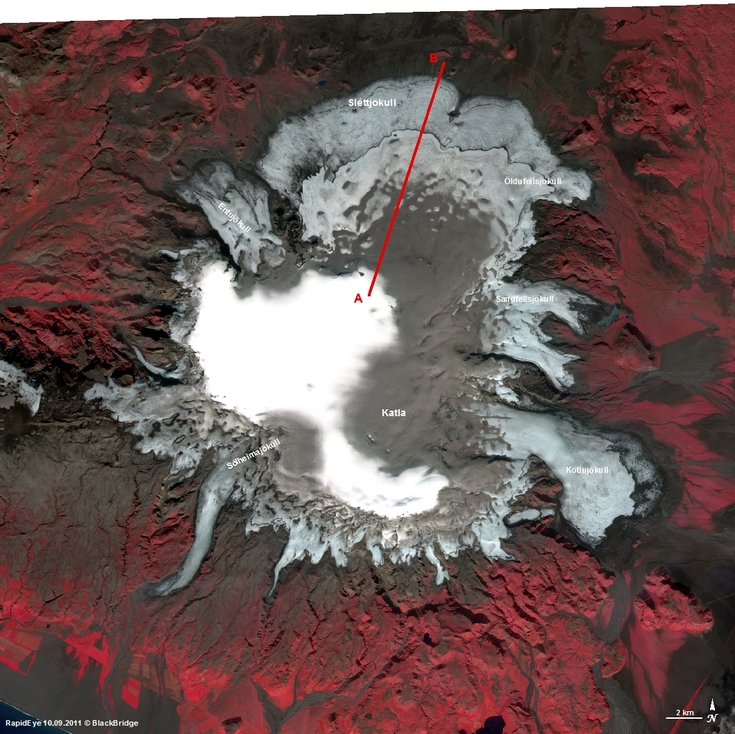
Mýrdalsjökull
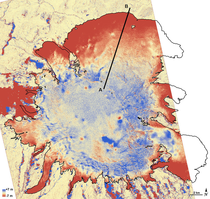
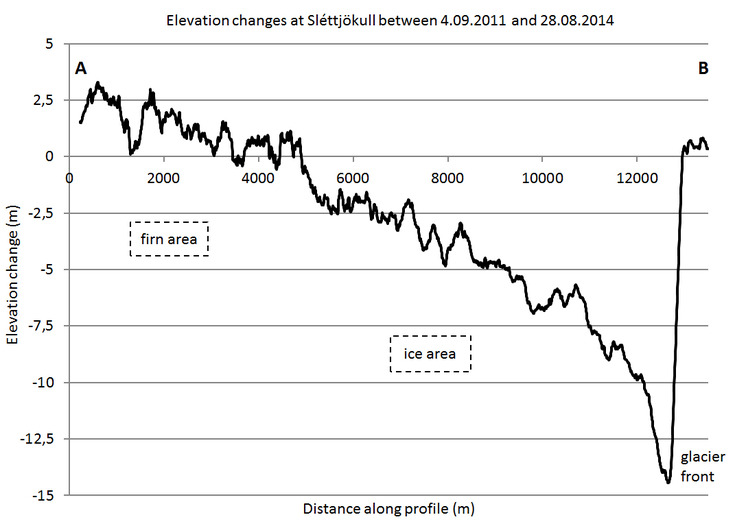
TanDEM-X DEM differencing was applied in order to investigate the mass balance at Mýrdalsjökull. A detailed analysis is shown along a profile at Sléttjökull outlet glacier.
Between 2011 and 2014 there is a height reduction of up to 10 m in the ablation area, whereas a gain of only about 1 m appeared in the accumulation area.
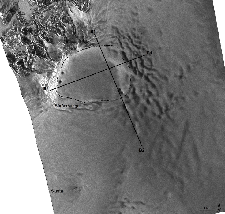
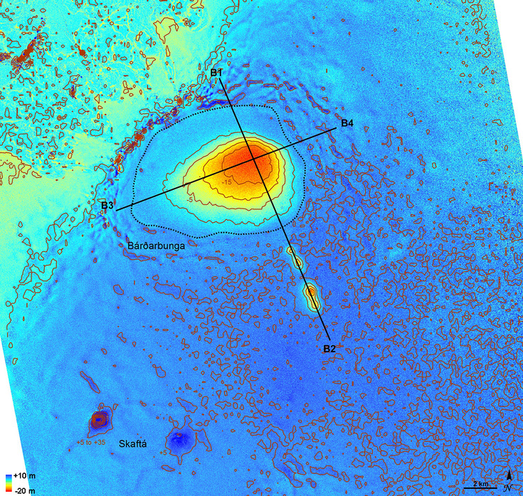
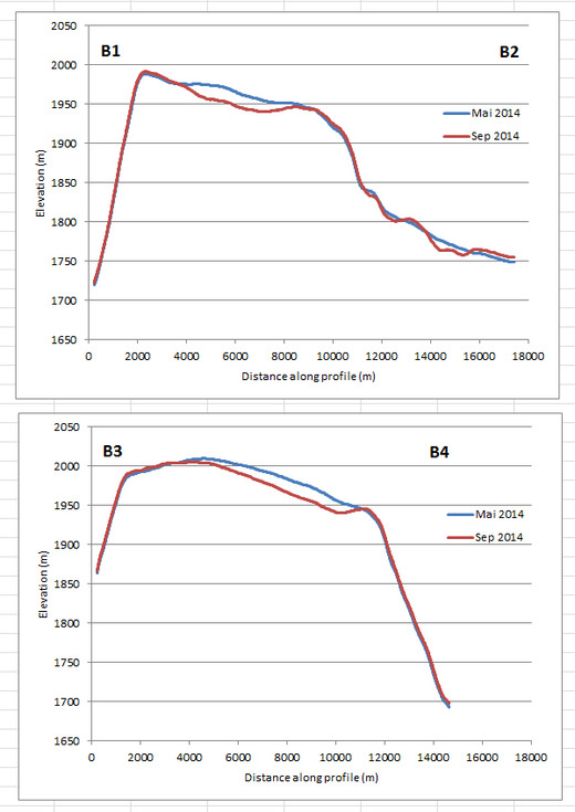
Bárðarbunga
A TanDEM-X data pair from 16.05.2014 and 14.09.2014 demonstrates ice subsidence within the Bárðarbunga caldera, which occured along with high seismic activity and a fissure eruption at Holuhraun (see NATURAL HAZARDS).
Two profiles show a depression up to 19 m deep and 7 km wide at September 14th, 15 days after the fissure eruption had started.
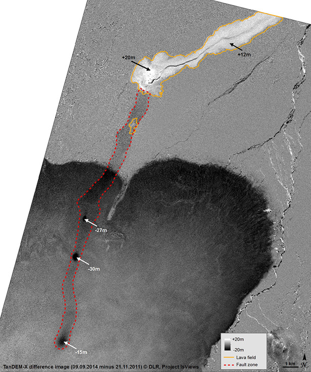
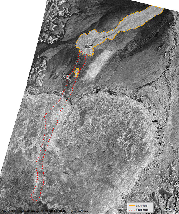
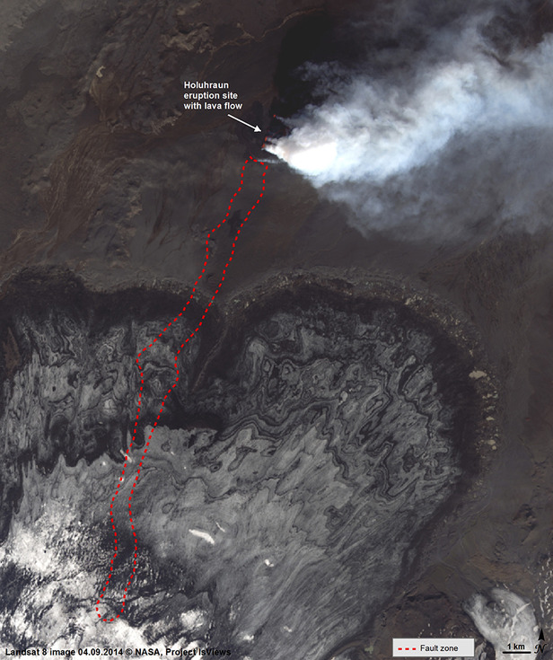
Holuhraun
TanDEM-X data differencing reveals amazing information about Holuhraun eruption site, which cannot be seen on radar or optical imagery.
TanDEM-X differencing of a RawDEM from 21. November 2011 and 9. September 2014 (11 days after the eruption started) shows a fracture zone that starts at the initial eruption site and reaches about 18 km south into Dyngjujökull outlet glacier. Furthermore, there are three depressions within the rift, up to 30 m deep.
The DEM differencing also shows that the lavafield was already up to 20 m heigh on 9.9.2014. The front of Dyngjujökull appears in black due to ice melt.