

First results
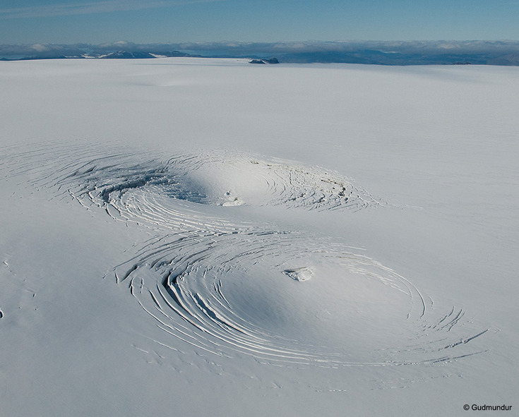
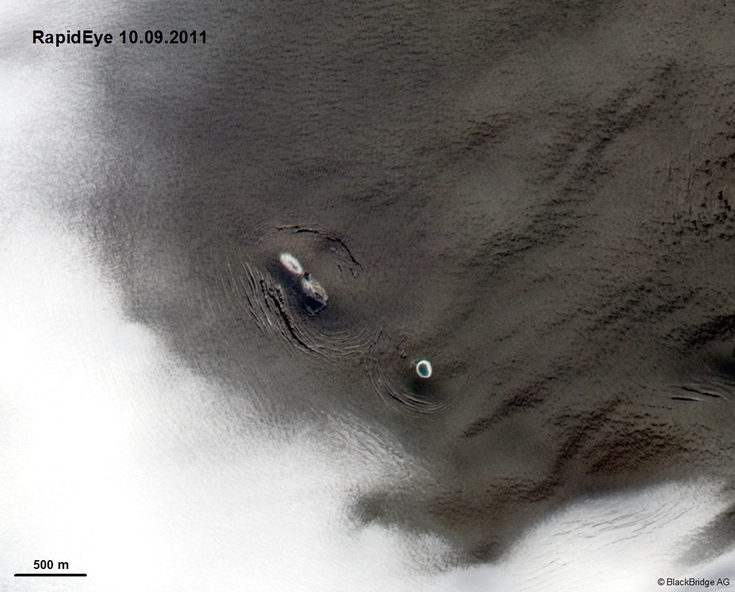
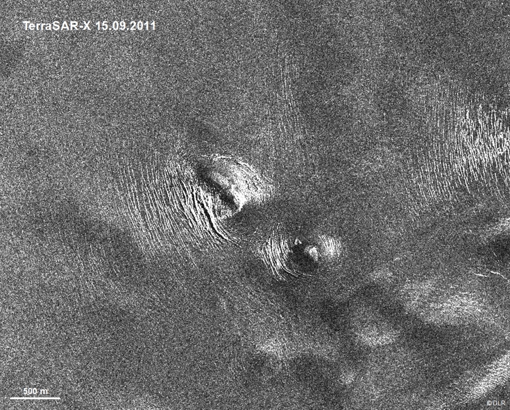
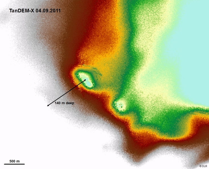
Ice cauldrons
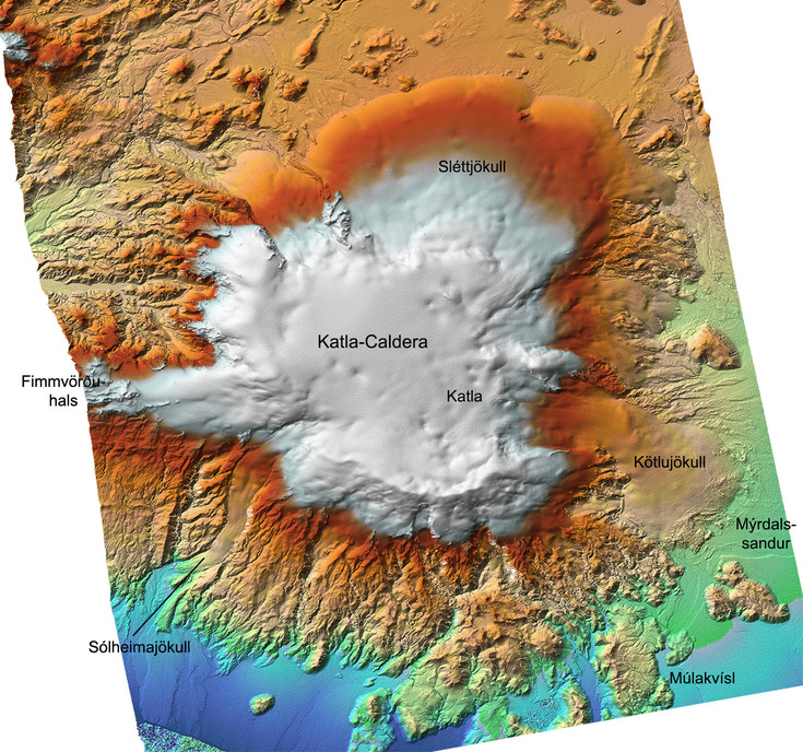
The two ice cauldrons, which developed south west of Katla central volcano during the jökulhlaup on 9th July 2011, are documented very well with remote sensing. A time series of TerraSAR-X data shows a deepening of the depressions until the middle of October. Furthermore, aerial photographs and optical RapidEye images as well as LiDAR and TanDEM-X elevation data of the two ice cauldrons exists. Thus, the cauldrons serve as an excellent case study in view of the development of an early warning system by automatic detection.
Applying the feature tracking method and image analysis of the TanDEM-X RawDEMs shows promising results.
TanDEM-X elevation data
A comparison of the TanDEM-X elevation data, generated by radar interferometry, with very high resolution LiDAR data shows very good agreement. This is an important result because to date it is not yet known how a possible interaction of the X-band signal with the glacier surface affects the digital elevation models.
TanDEM-X image differentiation shows promising results. With data from late summer 2011 and summer 2012 the development of ice cauldrons, ice melting and the gain of firn snow on the ice plateau of Mýrdalsjökull could be detected.
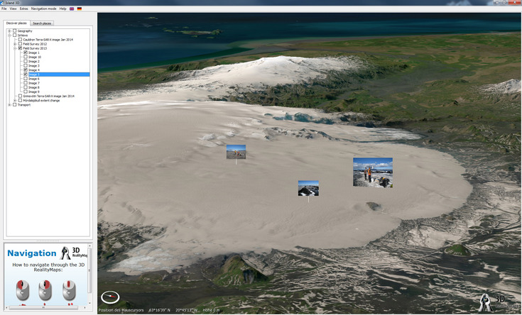
3D map
In view of operational Copernicus services, the project results are integrated in a user-friendly, high resolution 3D visualisation environment. The first step towards this was the generation of a RapidEye image mosaic of whole Iceland. Altogether 267 nearly cloud-free image tiles were merged and colour matching applied. Together with digital elevation data (resolution 50 cm - 20 m), RSS GmbH created a 3D modell of Iceland. In the range of the IsViews research areas very high resolution aerial imagery (HRSC, UltraCam) as well as geodata and first results (e.g. glacier margins, fieldwork information, TanDEM-X data) are integrated into the 3D map. In the future, hazard zones and possible evacuation measures will be demonstrated in the 3D map.
The unique, interactive 3D visualisation of Iceland is presented in a video by RSS GmbH.