

Askja rockslide
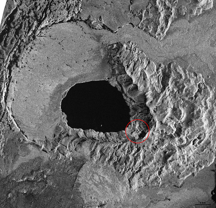
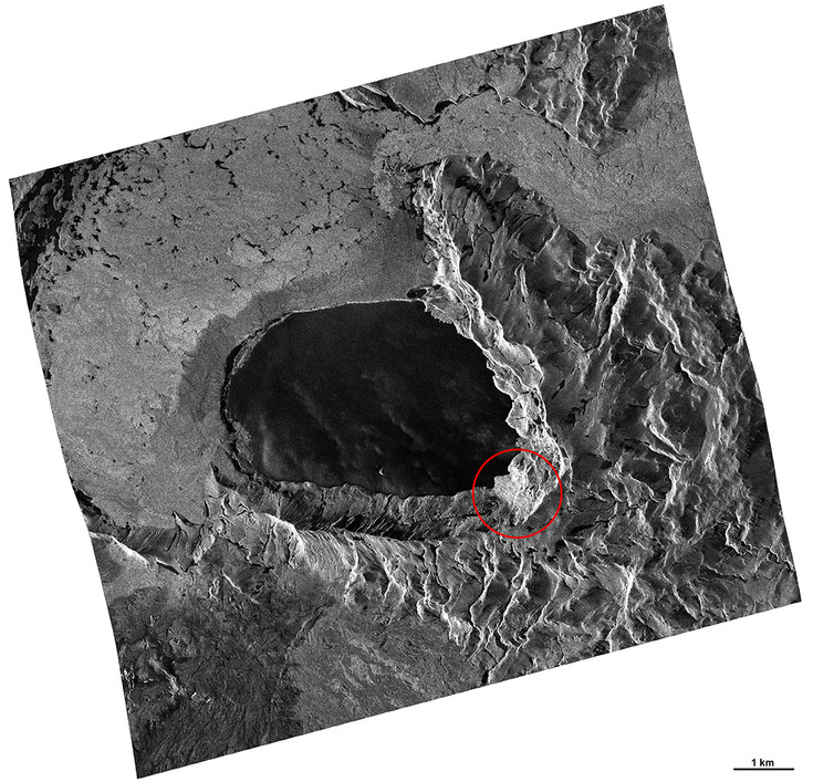
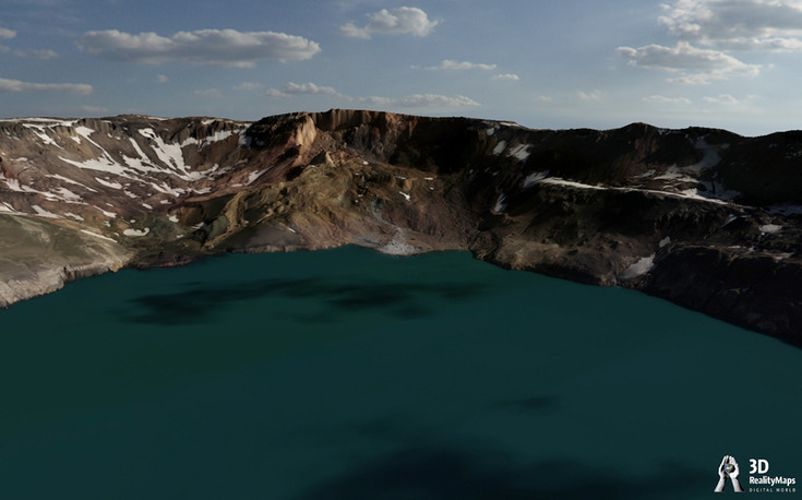
Late at night on 21 July 2014 an enormous rockslide fell into lake Öskjuvatn from the southeastern rim of Askja. Askja is a central volcano with a large caldera of about 9 km in diameter, situated few kilometers north of Bárðarbunga.
The rockslide had a volume of 30-50 million m³ and triggered a tsunami that reached up to 30 m elevation above the water level and about 400 m horizontally into the flatland northwest of the lake (www.vedur.is).
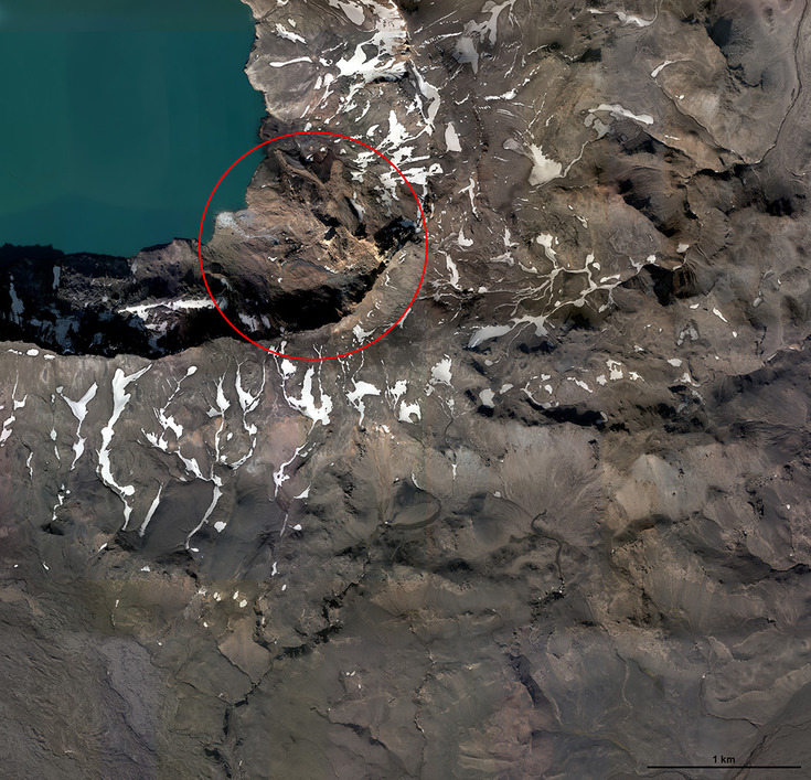
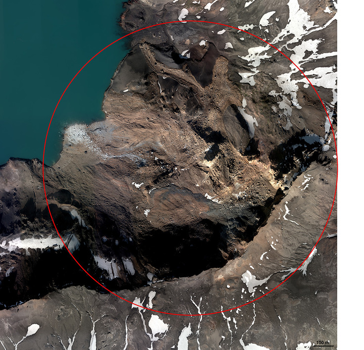
The approx. 800 m wide release area can be clearly identified in a TerraSAR-X Stripmap image from 4.9.2014 (1.25 m pixel size), a TerraSAR-X Staring Spotlight image from 29.8.2014 (0.75 m pixel size), and an UltraCam image from 27.8.2014 (0.1 m pixel size).
The rim of the caldera is geologically a very young area (eruption 1875) and thus relatively unstable. Snow melting and warm temperatures, as before the event existed, are additional triggers for rockslides.
Further rockslides at Askja are expected. Since the northshore of lake Öskjuvatn is a popular tourist sight (see results), natural hazard monitoring is essential.
By acquiring very high resolution UltraCam data few weeks after the event and 3D visualisation of the area, IsViews makes an important contribution to a better risk assessment and future hazard monitoring.