

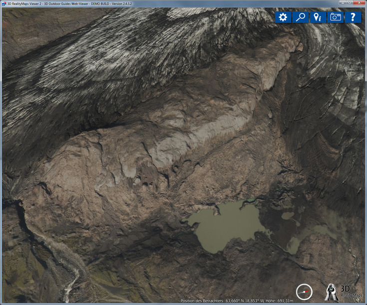
Mýrdalsjökull glacier margin 2014
mapped with UltraCam and 3D data
18.02.2016
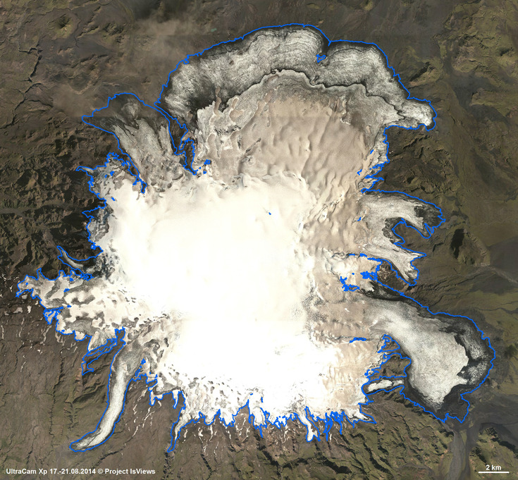
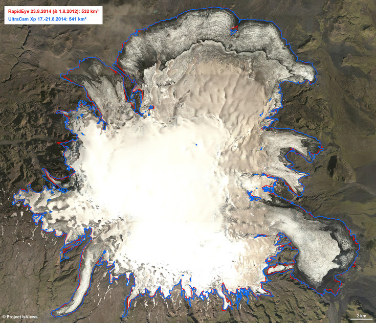
The glacier margin of Mýrdalsjökull was mapped with very high resolution UltraCam Xp data, acquired in August 2014 with a spatial resolution of 25 cm. The resulting glacier area is 541 km².
Compared to the area estimated by means of 5 m resolved RapidEye imagery, also acquired in August 2014, it is 9 km² larger. The main reason for this difference are debris and ash covered glacier margins which cannot be detected on RapidEye imagery.
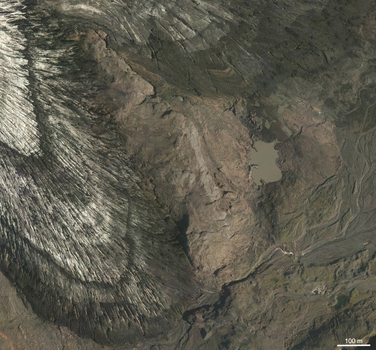
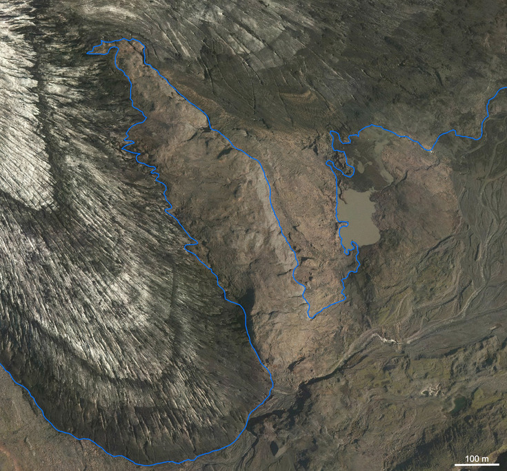
Even with very high resolution UltraCam imagery, the interpreter needs in situ knowledge to correctly map the glacier margin due to debris and ash cover.
3D visualisation of the glacier margin proofed to be essential for detection of debris and ash covered glacier margins.
 Using UltraCam 3D data is a cost-effective and time-saving way to map large and remote glaciers with high detail!